
India’s Naming and Its Vastness India, known for its grandeur and cultural richness, derives its nomenclature from the illustrious Mahamanav ‘Bharat’. Initially termed ‘Bharat’ after the dwellers along the Indus River, it gained the moniker ‘Hindustan’ by the Iranians. Over time, the Romans referred to the Indus River as ‘Indus’ and the land as ‘India’.
Geographical Dimensions Covering an expansive area of 3,287,263 square kilometers, India stands as the seventh-largest country globally, surpassing the United States, Canada, Brazil, Russia, China, and Australia. The country’s natural borders are delineated by the Himalayas to the north, the Arabian Sea to the southwest, the Bay of Bengal to the southeast, and the Indian Ocean to the south.
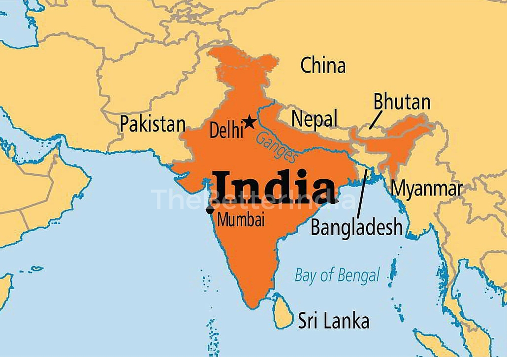
India’s Distinct Borders
- India-China Border: The MacMahon Line marks the boundary between India and China, established during the Shimla Summit of 1914 with representatives from India, China, and Tibet.
- India-Myanmar Border: Emerging from the Himalayas, this boundary encompasses eastern mountain ranges like Lushai, Patkai, and Arakan, encompassing states like Assam, Meghalaya, Arunachal Pradesh, Mizoram, Nagaland, and Manipur.
- India-Bangladesh Border: A regional political boundary separating Bangladesh and India, embracing Western Bengal, Assam, Tripura, and Meghalaya.
- India-Pakistan Border: The western border between India and Pakistan remains contentious, especially concerning the disputed region of Kashmir. Despite efforts post the Tashkent Agreement, the resolution remains elusive.
- Indian Maritime Boundary: With a coastal length of 6,100 kilometers, India’s southern expanse extends into the Indian Ocean, comprising the Bay of Bengal and the Arabian Sea, with the Gulf of Mannar separating it from Sri Lanka.
India’s Natural and Artificial Boundaries India is enclosed by the Himalayas to the north, the Arabian Sea to the southwest, the Bay of Bengal to the southeast, and the Indian Ocean to the south. Natural barriers like dense forests, steep gorges, and swift-flowing rivers restrict access between India and Myanmar.


The country’s artificial boundaries are with Nepal, Bhutan, Tibet (China), Bangladesh, Myanmar, Pakistan, and Afghanistan, forming an intricate geopolitical landscape.
Through various epochs, India has welcomed diverse communities, shaping its borders and its rich cultural heritage.


Discussion about this post